Amazing Limited Time Offer !
Call : +91 7771811100, +91 7771811104
Accurate Surveying and Construction



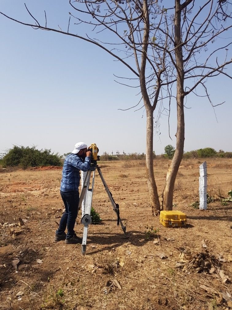
Construction and infrastructure development works may sometimes go beyond what we see on the surface level. The presence of underground cables, pipes, drainage, reinforcements, underground structures and cavities may pose unforeseen difficulties during excavation and development. Thus, proper knowledge of subsurface environment becomes necessary before undertaking any construction activity. GPR Survey in Chhattisgarh serves as a non-destructive way of studying the subsurface environment without undertaking extensive excavation at once. GPR Technology utilizes electromagnetic waves to identify and map subsurface objects enabling construction professionals, contractors, infrastructure developers, and project owners to know the possibilities that may exist underground before starting the process.
ASurvey offers GPR along with some other surveying solutions such as geotechnical investigation, DGPS, mine survey, pipeline route survey, topographic survey, geophysical survey and soil testing.
GPR, which stands for Ground Penetrating Radar, is a method of geophysical surveying that is done to study the subsurface conditions. In this method, an electromagnetic pulse is transmitted into the earth’s surface, which gets reflected back by various objects present in the subsurface.
There are some of the features that can be investigated using a professional GPR Survey in Chhattisgarh such as:
The depth and level of detection would vary depending upon soil type, moisture content, material type, frequency of the antenna, and target features.
There is considerable construction, industry, mining, road and pipeline projects and infrastructure development in Chhattisgarh. The cities and industrial zones like Raipur, Bilaspur, Durg, Bhilai, Korba and others have different kinds of pre-existing infrastructures and ground conditions.
Prior to excavation, drilling, laying foundations or constructing roads, there is a need for project management team to be aware of what exists underground.
The GPR Survey in Chhattisgarh can assist in conducting such initial investigations, which will be able to aid project managers with better planning of the excavation, foundations, utilities and structural changes.
ASurvey operates from Korba, Chhattisgarh, and includes mining and minerals projects, construction and infrastructure projects, industrial and plant projects, dams and hydro projects, and roads and pipeline projects under its sectors.
1. Buried Utility Detection
Through GPR surveys, the detection of underground utility systems like pipelines, cables, conduits, and drains can be done to avoid any problems in excavation.
2. Site Investigation Before Construction
Before embarking on any construction activity, additional investigation into what exists in the soil beneath can be conducted using GPR survey technology. This is especially applicable in developed sites where there could be previous buildings or buried features.
3. Reinforcement and Concrete Feature Detection
GPR surveys can be used to detect reinforced and embedded features in concrete buildings. Information gathered through such surveys can be used during renovation, repairs or construction of any feature.
4. Road/Pavement Investigation
In road construction and rehabilitation, investigation of the subsoil can be conducted using the GPR technology. This helps in detecting voids or anomalies under the road/pavement structure.
5. Detection of Cavities and Voids
The existence of underground cavities or voids can pose serious challenges when constructing or building infrastructure on the land. Through GPR surveys, such areas can be detected and investigated.
A professional GPR Survey in Chhattisgarh usually involves the following process steps.
Step 1: Analysis of Requirements for the Project
The survey team studies the objectives of the project, site conditions, relevant drawings, and locations to be surveyed.
Step 2: Preparation for the Survey
The survey location, the paths for scanning, equipment, and proper antenna frequency are decided based on the site and the requirements of the survey.
Step 3: Performing GPR Scanning
The GPR equipment is used to scan the survey area to receive the reflection signals of electromagnetic waves from the underground materials.
Step 4: Data Processing
The acquired data is processed using the appropriate digital techniques to obtain important reflections.
Step 5: Data Interpretation
The survey professionals interpret the data to identify potential utilities, structures, voids, reinforcement, and other features detectable by GPR.
Step 6: Report Preparation
The results of the survey can be shown through the use of maps, profile, drawings, images, observations, and technical reports depending on the requirements of the project.
While GPR is a useful technique for initial studies, it cannot substitute every type of geotechnical test that needs to be carried out. GPR gives non-destructive information about all detectable subsurface objects, while geotechnical investigation gives direct information about soils and rocks.
Thus, when carrying out GPR survey in Chhattisgarh and conducting proper geotechnical investigation, one gets better results regarding ground conditions.
In case of foundation works, further investigations such as boring, soil samples, SPT or pile tests etc. may be required according to the project design. ASurvey provides geotechnical investigation and soil testing as one of their services.
Industries in Which GPR Survey Is Used
Ground-penetrating radar surveying can serve many industries such as:
Residential construction
Commercial construction
Industrial facilities
Mining operations
Roads and highways
Pipeline operations
Railways
Bridges
Dams
Hydroelectric projects
Government infrastructure
Utilities
Institutional facilities
Structural refurbishment operations
This makes GPR Survey in Chhattisgarh an important element of modern-day site investigations and infrastructure projects.
Ground-penetrating radar surveying can serve many industries such as:
This makes GPR Survey in Chhattisgarh an important element of modern-day site investigations and infrastructure projects.
Accurate Surveying and Construction is a service provider company, which offers surveying and consultancy services utilizing advanced surveying equipment and civil engineers & surveyors. The services offered by the company include GPR surveys, DGPS surveys, drone surveying, geophysical and geological surveys, mine surveys, pipeline route surveys, topographic surveys, rebar detection surveys, and soil testing.
It also claims that the company serves clients from all over India and emphasizes accurate measurement and result delivery along with efficient surveying solutions.
For projects in Chhattisgarh, where you require underground utility mapping, subsurface investigation, concrete scanning, or construction planning services, ASurvey can design a survey methodology as per the project requirements.
Proper understanding of the underground conditions helps in having an organized and effective construction process. GPR Survey in Chhattisgarh is a method that enables non-invasive exploration of the underground utilities, buried structures, concrete reinforcement, voids, and any other subsurface structure detectable through GPR.
In combination with the geotechnical survey, DGPS survey, mining survey, pipeline route survey, topographic survey, and soil test when necessary, GPR may be a good source of useful information for engineering and construction processes.
If you are about to start any construction, mining, industrial, road, pipeline or infrastructure works in Chhattisgarh, contact ASurvey for further GPR and subsurface investigations.