Amazing Limited Time Offer !
Call : +91 7771811100, +91 7771811104
Accurate Surveying and Construction

Transmission Line Survey Service in Bilaspur
Routing a power line through unsuitable terrain can cause budget overruns and project delays. A Transmission Line Survey Service in Bilaspur ensures the safest, most cost-effective path is mapped out before erecting any towers.
With accurate field data, you can confidently plan every span and structure, eliminating guesswork. Given Bilaspur’s expanding energy infrastructure, precise line surveys are more critical than ever for successful project execution.
What Is a Transmission Line Survey?
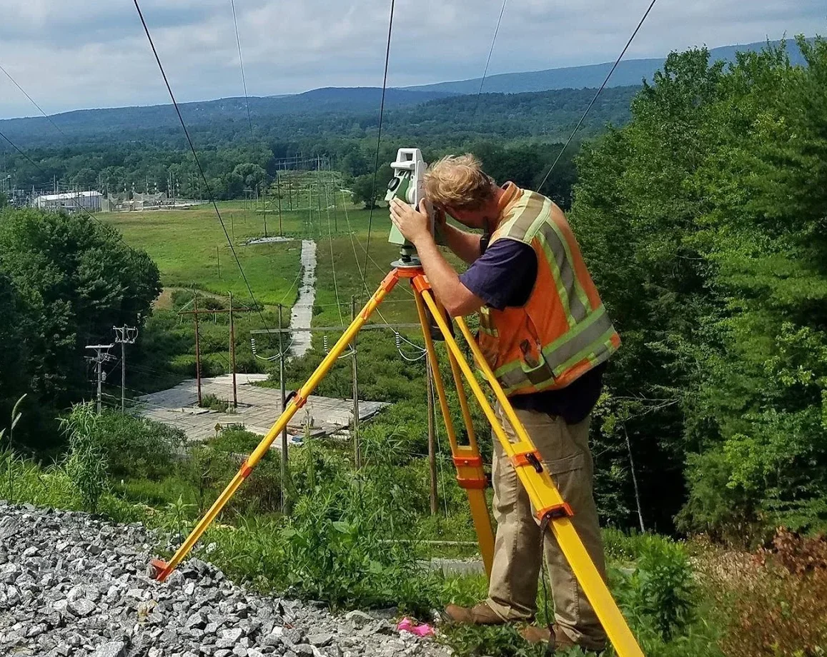
A transmission line survey is a specialized engineering survey designed to identify the optimal route, alignment, and tower locations for high-voltage power transmission lines. The process includes:
Advanced tools like DGPS, total stations, and drone-based aerial surveys are used to generate accurate profile drawings and tower schedules. These deliverables serve as the foundation for detailed engineering and Right of Way (RoW) planning.
Importance of Transmission Line Survey Service in Bilaspur
Bilaspur, as a key industrial and energy hub, benefits greatly from precise transmission line surveys that offer:
Applications of Transmission Line Surveys
Survey Methodology
Technologies Used
These technologies ensure accurate route planning and reliable project data for successful transmission line projects in Bilaspur.
Why Bilaspur Needs Reliable Line Surveys
Bilaspur is part of a rapidly growing energy and industrial belt with increasing power demand every year. New transmission corridors are crucial to connect generation hubs to homes, factories, and expanding towns.
The region’s varied terrain—comprising plains, slopes, and dense vegetation—makes terrain-aware surveys essential. A professional Transmission Line Survey Service in Bilaspur accounts for these challenges, ensuring the construction of durable and efficient power lines.
Who Needs This Service?
Transmission line survey services are essential for:
Conclusion
A Transmission Line Survey Service in Bilaspur is crucial for the successful planning and execution of power transmission infrastructure. Accurate route alignment, precise tower positioning, and thorough terrain analysis help optimize project costs, enhance safety, and ensure efficient power delivery. Leveraging advanced surveying technology and experienced professionals, these surveys provide the essential data needed for modern electrical infrastructure development.