Amazing Limited Time Offer !
Call : +91 7771811100, +91 7771811104
Accurate Surveying and Construction

Professional Contour Survey Solutions for Accurate Land Development
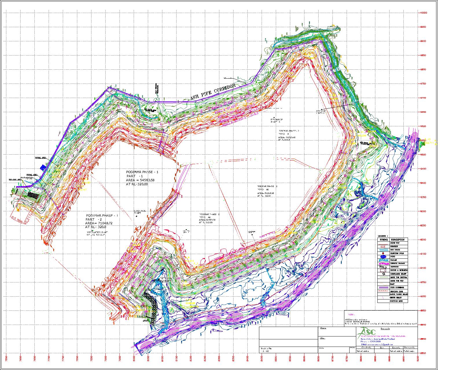
Contour Survey Services in Delhi are vital for construction, infrastructure, land planning, and engineering projects. These surveys map elevation and land shape by identifying contour lines, which indicate points of equal height above a reference level. This detailed terrain data helps architects, engineers, builders, and developers make informed decisions during project planning and execution.
Whether for residential buildings, commercial complexes, industrial facilities, road projects, or landscaping, accurate contour survey data is essential for success. Professional surveyors use advanced equipment like Total Stations, GPS systems, and drones to provide precise and reliable results.
What Is a Contour Survey?
A contour survey measures the elevation and slope of land, representing it with contour lines that connect points of equal height. This information helps engineers and architects understand drainage, identify high and low spots, calculate cut-and-fill volumes, and design structures that complement the natural terrain.
Our survey teams use modern tools like Total Stations, GPS/GNSS equipment, and drone photogrammetry to capture precise elevation data on sites ranging from small residential plots to large industrial or agricultural lands.
Why Contour Surveys Matter
Skipping a proper contour survey can cause drainage problems, foundation issues, and budget overruns. A precise contour survey helps you to:
Importance of Contour Survey Services in Delhi
Delhi’s rapid urban growth makes accurate land assessment crucial for successful development projects. Contour Survey Services in Delhi provide essential insights into site conditions before construction begins.
Key Benefits:
Our Contour Survey Services
We provide comprehensive contour surveys across diverse project types:
Advanced Survey Equipment
Our team employs cutting-edge technology for precise, reliable results:
Get Started Today
Ready to build on solid ground? Contact our team for professional contour survey services in Delhi. Request a free consultation and quote to give your project the accurate foundation it deserves.
A contour survey is more than just a technical step—it’s the key to a smooth, cost-effective project from start to finish. Understanding your land’s true shape helps you avoid drainage problems, foundation issues, and unexpected costs.
Our experienced team in Delhi combines advanced tools, local expertise, and clear communication to handle projects of any size. Whether planning a home, commercial space, or infrastructure development, accurate contour data sets you up for success.