Amazing Limited Time Offer !
Call : +91 7771811100, +91 7771811104
Accurate Surveying and Construction



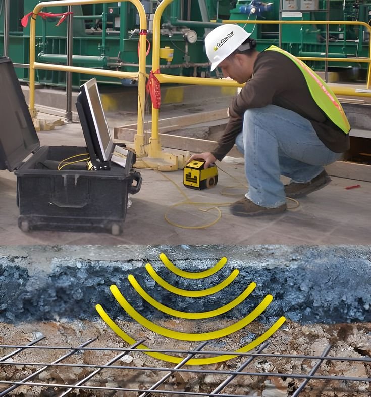
Modern construction projects demand detailed subsurface information beyond the surface level. Before excavation, foundation laying, road construction, drilling, or utility installation, understanding buried elements like pipelines, electrical cables, reinforcement, cavities, and conduits is crucial as they impact construction processes. A professional Ground Penetrating Radar (GPR) Survey in Hyderabad offers a non-destructive, advanced method to examine subsurface conditions. GPR uses electromagnetic signals to detect underground changes, generating data that experts interpret for engineering and construction applications.
A Survey delivers expert surveying and investigation solutions for construction, infrastructure, industrial, commercial, and engineering projects. By integrating modern technology with systematic fieldwork, the company equips clients with valuable information for improved project planning.
Ground Penetrating Radar is a geophysical technology that sends electromagnetic waves into the ground or other materials. When these waves encounter changes in material properties or buried objects, some energy reflects back to the radar antenna.
The reflected signals are recorded and processed into radar profiles, which professionals interpret to identify underground utilities, reinforcement, voids, buried structures, and other subsurface anomalies.
Unlike traditional excavation, GPR offers a largely non-invasive method, preserving existing ground, pavement, floors, or structures.
Hyderabad is experiencing rapid residential, commercial, industrial, institutional, and infrastructure growth. Urban areas often contain complex underground utility networks installed over time.
Water pipelines, drainage, electrical cables, and communication conduits may not be accurately documented. Excavation without proper information risks utility damage, delays, increased costs, and safety hazards.
A Ground Penetrating Radar Survey in Hyderabad helps project teams assess the subsurface conditions before intrusive construction activities, ensuring safer and more efficient project execution.
Underground Utility Detection
GPR is highly effective for detecting underground utilities and buried features such as:
Concrete Investigation
GPR can examine concrete structures to identify:
Void and Anomaly Detection
GPR detects unexpected voids or anomalies that may affect infrastructure such as roads and foundations. While it may not confirm every anomaly’s nature, it guides engineers toward areas needing further investigation.
Road and Pavement Assessment
Roads and paved areas often have multiple layers and hidden infrastructure. GPR complements traditional engineering methods to support:
Hyderabad’s diverse projects—from residential and commercial buildings to industrial facilities, roads, and institutional campuses—face different subsurface challenges. GPR surveys help by:
This reduces the need for unnecessary exploratory excavation while delivering valuable preliminary data.
GPR is part of a wider suite of surveying technologies. Combining methods offers comprehensive site insights, such as:
A Survey offers tailored professional surveying solutions to fit the technical needs of any project.
Understanding subsurface conditions before excavation reduces uncertainty and enhances construction planning. Ground Penetrating Radar offers a modern, non-destructive method to investigate ground, concrete, pavement, and structural surfaces.
From detecting underground utilities and assessing concrete to identifying voids and supporting infrastructure planning, GPR serves diverse engineering needs.
As Hyderabad expands across residential, commercial, industrial, and infrastructure sectors, a Ground Penetrating Radar Survey provides essential subsurface insights for project owners, engineers, contractors, and consultants before intrusive work begins.
A Survey combines advanced technology with professional expertise to deliver accurate, practical investigations. Choosing the right survey method early supports safer excavation, informed decisions, and smoother project execution.