Amazing Limited Time Offer !
Call : +91 7771811100, +91 7771811104
Accurate Surveying and Construction



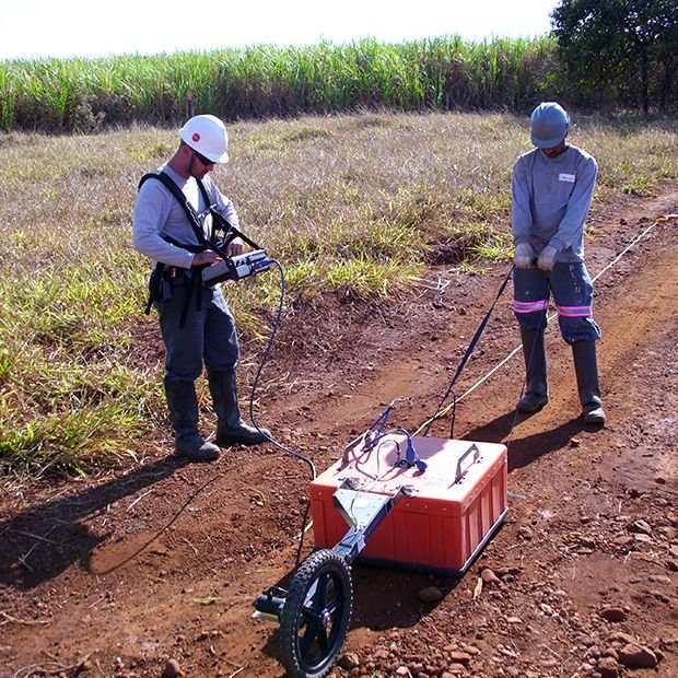
Tamil Nadu is one of India’s fastest-growing states, marked by rapid development in infrastructure, industrial parks, highways, ports, and urban construction. Every new project—whether a metro line in Chennai, highway expansion in Coimbatore, or a factory foundation in Tiruchirappalli—relies on one essential factor: knowing what lies beneath the ground before construction starts. This is where a Ground Penetrating Radar (GPR) Survey in Tamil Nadu becomes indispensable. At Accurate Surveying and Construction, we offer professional GPR surveys that help engineers, contractors, and project owners detect underground utilities, voids, rebar layouts, and soil anomalies quickly and precisely—without any digging.
Ground Penetrating Radar (GPR) Survey is a non-destructive geophysical technique that uses high-frequency electromagnetic waves to map subsurface features. A radar antenna sends signals into the ground, which reflect off buried objects like pipes, cables, rebar, voids, or soil layers. These reflected signals are recorded and processed into images showing the depth, size, and location of underground structures.
Unlike traditional excavation methods, GPR is fast, safe, and non-invasive, making it ideal for modern construction and infrastructure projects across India.
This makes GPR surveys an essential tool for safe, efficient, and compliant construction in Tamil Nadu’s growing infrastructure sector.
Choosing a professional GPR Survey service in Tamil Nadu can significantly enhance safety, efficiency, and cost-effectiveness in engineering and construction projects.
Our Ground Penetrating Radar (GPR) services are tailored to meet specific project needs and site conditions to provide clear subsurface imaging for utilities, reinforcement, voids, and underground obstructions, aiding excavation planning and structural assessments.
Typical Survey Stages:
Site Assessment:
Review of site conditions, project requirements, accessible areas, and investigation goals.
Survey Planning:
Development of a tailored survey methodology and scanning pattern based on project specifics.
GPR Data Collection:
Operation of GPR equipment over the designated survey area to gather radar data.
Data Processing:
Processing and interpretation of radar data to detect significant subsurface features.
Interpretation:
Expert analysis to identify utilities, structural elements, voids, reinforcement, or other anomalies.
Reporting:
Compilation of findings into a comprehensive technical report or deliverable suitable for engineering and construction purposes.
Accurate Surveying and Construction is your reliable partner for precise and efficient subsurface investigations and related surveying services.
Q1. How deep can a GPR survey detect underground objects?
Depending on soil conditions and the antenna frequency used, GPR can typically detect objects from a few centimeters up to several meters below the surface.
Q2. Is Ground Penetrating Radar Survey safe for use near existing structures?
Yes, GPR is completely non-destructive and safe to use near buildings, roads, and active utility lines since it does not require any excavation.
Q3. How long does a typical GPR survey take?
The duration depends on the size and complexity of the site, but most surveys are completed within a few days, followed by data processing and reporting.
Q4. Which cities in Tamil Nadu do you cover for GPR survey?
We provide Ground Penetrating Radar Survey services across major Tamil Nadu cities including Chennai, Coimbatore, Madurai, Tiruchirappalli, Salem, Tirunelveli, and other key project locations.
Understanding subsurface conditions is vital for safe and efficient construction planning. A professional Ground Penetrating Radar Survey in Tamil Nadu enables identification of underground features without destructive excavation.
From utility mapping and reinforcement detection to infrastructure development and structural assessment, GPR technology delivers valuable subsurface insights to support informed engineering decisions.
Accurate Surveying and Construction combines advanced surveying technology with experienced professionals to offer reliable geospatial solutions. Choosing a knowledgeable surveying partner ensures better project planning, reduced uncertainty, and safer execution for your construction projects in Tamil Nadu.