Amazing Limited Time Offer !
Call : +91 7771811100, +91 7771811104
Accurate Surveying and Construction



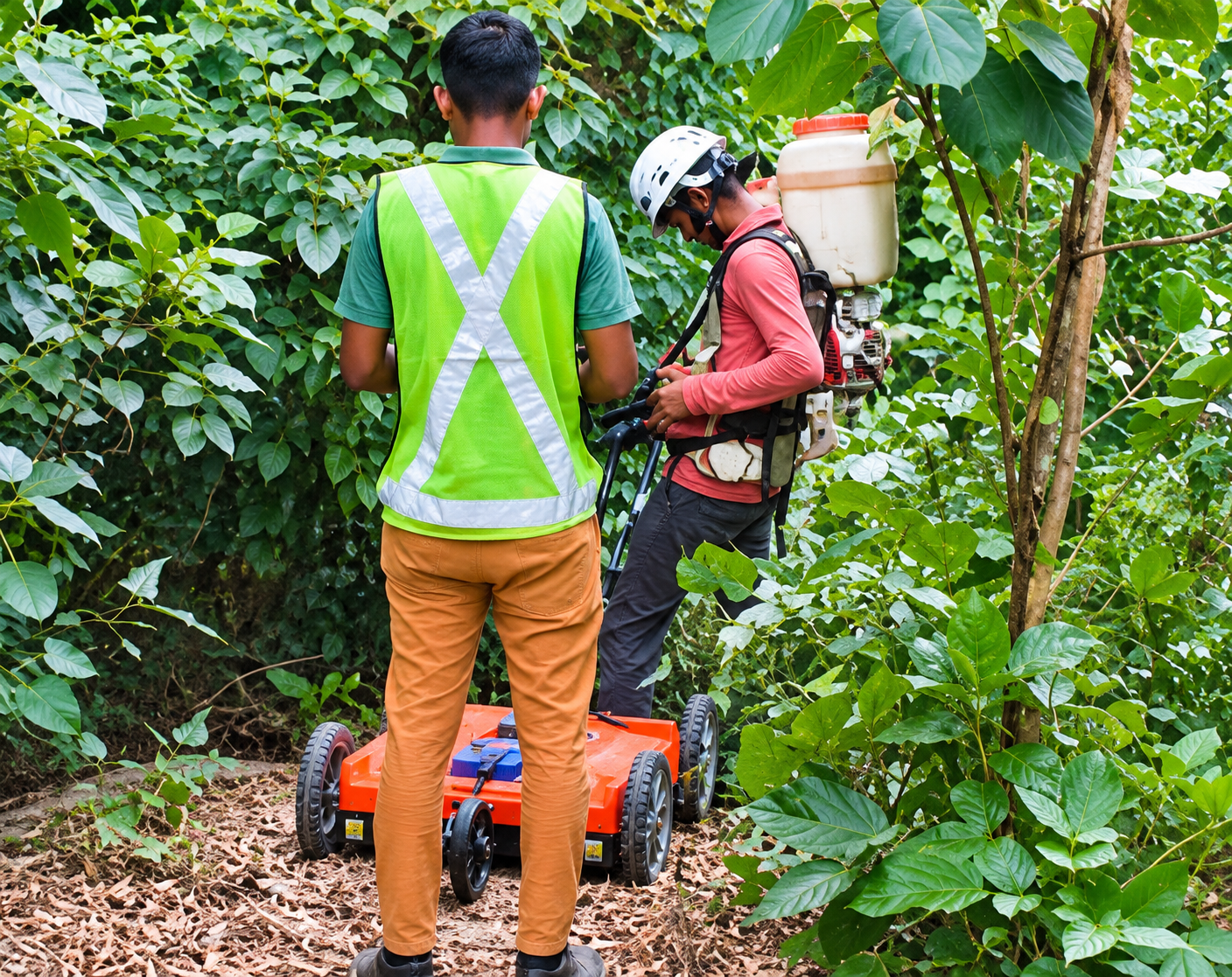
Every safe and durable structure starts with a solid understanding of what lies beneath the ground. Before casting columns or driving piles, engineers must accurately assess the soil, rock formations, and underground utilities at the site. This is the core purpose of GPR Survey, Geotechnical Investigation, and Piling in Jabalpur, Madhya Pradesh—a comprehensive process that provides builders, contractors, and government agencies with reliable, ground-truth data to design and construct confidently.
Jabalpur’s unique subsurface conditions, characterized by rocky outcrops, riverbank zones along the Narmada River, and rapidly expanding urban areas, pose specific challenges to construction projects. Accurate Surveying and Construction has tailored its GPR Survey, Geotechnical Investigation, Piling in Jabalpur, Madhya Pradesh to address these local complexities. The service seamlessly integrates radar-based subsurface mapping, borehole soil testing, and hydraulic piling execution into a coordinated, efficient workflow—ensuring projects are built on a foundation of precise knowledge and expert execution.
Ground Penetrating Radar (GPR) operates by sending high-frequency electromagnetic pulses into the ground and recording their reflections. Different underground materials—such as soil, rock, water, metal pipes, cables, or voids—reflect these pulses uniquely. This allows engineers to create detailed images of subsurface features without any excavation.
In a rapidly growing city like Jabalpur, GPR is more than a convenience—it’s a critical safeguard. With expanding underground utility networks, striking buried cables or water lines during excavation can cause costly delays and project disruptions. A well-executed GPR survey identifies these hazards early, accurately maps shallow rock layers, and provides contractors with a clear go/no-go assessment before heavy machinery arrives. This makes it the essential first step in any GPR Survey, Geotechnical Investigation, and Piling project in Jabalpur, Madhya Pradesh.
Following GPR’s shallow subsurface mapping, geotechnical investigation delves deeper with physical testing and analysis. This phase includes borehole drilling, Standard Penetration Testing (SPT), collection of disturbed and undisturbed soil samples, and comprehensive laboratory testing.
In Jabalpur, geotechnical investigations must consider:
Our geotechnical investigation services in Jabalpur include:
All collected data directly informs the structural design process, making GPR Survey, Geotechnical Investigation, and Piling in Jabalpur, Madhya Pradesh a deeply engineering-driven service—not just a generic checklist.
This comprehensive approach ensures that foundations are designed with precise knowledge of local subsurface conditions, optimizing safety, durability, and project success.
Piling is essential when surface soil cannot support structural loads or when deep foundations are required.
A typical project for GPR survey, geotechnical investigation, and piling in Jabalpur, Madhya Pradesh, follows a systematic workflow:
Site Assessment
Review project requirements, site accessibility, existing structures, available drawings, and investigation objectives.
Investigation Planning
Develop a detailed plan based on project type, structural needs, site conditions, and expected subsurface data.
GPR Survey
Conduct Ground Penetrating Radar scanning across selected areas to detect subsurface utilities, voids, reinforcement, or obstructions.
Borehole Investigation
Drill boreholes at strategic locations and depths to analyze soil and rock strata.
Soil Sampling and Testing
Collect representative soil samples for appropriate field and laboratory testing.
Data Interpretation
Analyze GPR results, borehole data, and soil test outcomes to understand site conditions comprehensively.
Foundation Planning
Utilize investigation findings to develop foundation and piling recommendations.
Piling Work
Execute piling operations following engineering approvals and project requirements.
An experienced partner enhances the quality and reliability of site investigations. ASurvey, operating since 2013, collaborates with civil engineers and surveyors using advanced instruments and modern construction equipment. The company prioritizes:
Accurate survey data is fundamental for sound engineering decisions. Beyond GPR and geotechnical investigations, construction projects often require:
ASurvey offers a broad portfolio of geospatial services including aerial LiDAR drone surveys, hydrographic, geological, road/rail/route, and demarcation surveys. This extensive capability supports coordinated surveying requirements throughout different project phases.
Don’t let unknown subsurface conditions jeopardize your Jabalpur project. A thorough GPR Survey, Geotechnical Investigation, and Piling process safeguards your budget, schedule, and—most importantly—the long-term safety of your structure.
Contact Accurate Surveying and Construction now for a free site consultation and quote. Our expert team is ready to mobilize across Jabalpur and the wider Madhya Pradesh region with the right equipment and skills tailored to your project needs.
Call us at: +91 77718 11100
Visit: asurvey.in to discover our full range of surveying, geotechnical, NDT, and piling services.